I have so many maps that I had thought I would not write anything and just do a show and tell. But once I started going through the collection I found myself transported immediately away on endless waves of memory. Map-memory. Rather like muscle memory in the way it seemed to operate quite outside of any conscious thought. Why had I not anticipated this? I’m not sure
.
Much as I have always loved maps, I guess I never saw them as anything to inspire emotion. But why ever not? Now I find they wrap me in memories in a way that even old photographs do not; perhaps simply because I look at the old photos from time to time, whereas the maps have just languished in a box, untouched for years other than once in a while when I open the box and toss in a couple more maps for the collection.
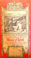
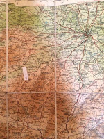
There are old ‘Tourists & Cyclists’ maps of various parts of Britain dating from somewhere early in the twentieth century, once used by my parents riding around on Dad’s motorbike in the 1920’s. One is of Shropshire, my home county. It is one of the linen-backed, more expensive variety, obviously bought to last. (I stuck an arrow on it, pointing at our house!)
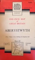
Then there are the common but most popular British maps, those on the one inch to one-mile scale. They were produced between 1952 and 1961 and covered every inch of the British Isles. I bought many of them for school-day, and later college, hikes. They were produced in great detail and made it almost impossible to get lost.
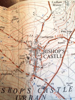
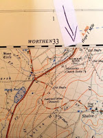
Even more detailed was the series, published around the same time as the one inch to the mile, was the one mile to 2 1/2 inches; maps so detailed they showed every single building. I also bought a lot of these, largely because by this time I was getting into geology in high school and they made fossil sites easier to find. Detailed geologic maps were not common then as they are today, but I had one very generalized map of Shropshire geology which I greatly valued. Fossil finds were mainly communicated by word of mouth, so a detailed map was almost essential. Our house was, as always seems inevitable, right on the joint of two maps, but I put an arrow again. It’s right on the edge of the map above where it says ROMAN GRAVELS. There are endless old Roman sites around there. Just to the left is marked a stone circle. It is small in size, as are the stones, but nevertheless an unmistakable prehistoric stone circle. My parents and I used to picnic there quite often, it’s a beautiful, very silent, remote, spot. At least it was then. Now many tourists apparently go there in the summer. On another one is the tiny town of Bishop’s Castle, where I went to the high school marked at the crossroads. Also, clearly marked is Stone House, the old workhouse now converted to the nursing home where my mum and dad both died. At the south end of the town is the church where they are buried.
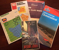
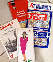
Then we come to stacks of maps that I, and then Betsy and I, have bought on our travels. They take me back with great joy to the many places we have been, but they tend to be more of the highway route variety of map and less emotive in detail than the old ones.
I love all maps, and these are a small percentage of my collection, but the old maps are special. There is somehow something surreal about seeing all these places that have loomed so large in my early life depicted so clearly before me on a long-forgotten map. I am grateful to whoever chose this topic for giving me the incentive to explore the contents of that dusty old box.
And, not for the first time, I find myself grieving for the current and future high-tech generations. I fear they will never know the magic of an old map, tattered from overuse, with pencil arrows flowing from a scribbled teenage note, trilobite fossils here. Who, with the very best of intentions, can find magic in the memories of Siri scolding, ‘you are going in the wrong direction! Complete a U-turn immediately it is safe to do so and return to the intersection.’ Seriously lacking in any sense of history!
I have decided against naming my next baby Siri.
© 31 Mar 2017
About the Author
I was born and raised in England. After graduation from college there, I moved to the U.S. and, having discovered Colorado, never left. I have lived in the Denver-Boulder area since 1965, working for 30-years at IBM. I married, raised four stepchildren, then got divorced after finally, in my forties, accepting myself as a lesbian. I have been with my wonderful partner Betsy for thirty-years. We have been married since 2013.
