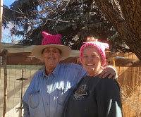
Maps, by Ray S

I believe that along with counting all the fingers and toes and necessary plumbing each one of us is issued a map. This is a map that charts out the many roads we may or may not venture onto. There will be the inevitable dead ends, forks in the road leading to where? Most of we dreamers look for the legend marking the Yellow Brick Road, and occasionally it is found. Then there are a good number of us that don’t study our map or perhaps never open it. We just head for the dark woods and wander aimlessly through life gathering rosebuds where we may.

If there is a goal, it just happens as we trudge on through the expedient trail or path.

It can happen to a fortunate select group that broke the seal on their maps to plan their routes to health, wealth, and of course, happiness. We’ve all met one of those hims or hers.

All of the roads on your map will lead to great and small adventures, and ultimately end at the same destination.

© 25 March 2017

About the Author

Maps, by Gillian

I have so many maps that I had thought I would not write anything and just do a show and tell. But once I started going through the collection I found myself transported immediately away on endless waves of memory. Map-memory. Rather like muscle memory in the way it seemed to operate quite outside of any conscious thought. Why had I not anticipated this? I’m not sure
.
Much as I have always loved maps, I guess I never saw them as anything to inspire emotion. But why ever not? Now I find they wrap me in memories in a way that even old photographs do not; perhaps simply because I look at the old photos from time to time, whereas the maps have just languished in a box, untouched for years other than once in a while when I open the box and toss in a couple more maps for the collection.
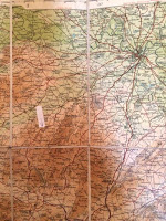
There are old ‘Tourists & Cyclists’ maps of various parts of Britain dating from somewhere early in the twentieth century, once used by my parents riding around on Dad’s motorbike in the 1920’s. One is of Shropshire, my home county. It is one of the linen-backed, more expensive variety, obviously bought to last. (I stuck an arrow on it, pointing at our house!)
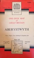
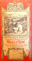
Then there are the common but most popular British maps, those on the one inch to one-mile scale. They were produced between 1952 and 1961 and covered every inch of the British Isles. I bought many of them for school-day, and later college, hikes. They were produced in great detail and made it almost impossible to get lost.
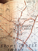
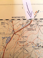
Even more detailed was the series, published around the same time as the one inch to the mile, was the one mile to 2 1/2 inches; maps so detailed they showed every single building. I also bought a lot of these, largely because by this time I was getting into geology in high school and they made fossil sites easier to find. Detailed geologic maps were not common then as they are today, but I had one very generalized map of Shropshire geology which I greatly valued. Fossil finds were mainly communicated by word of mouth, so a detailed map was almost essential. Our house was, as always seems inevitable, right on the joint of two maps, but I put an arrow again. It’s right on the edge of the map above where it says ROMAN GRAVELS. There are endless old Roman sites around there. Just to the left is marked a stone circle. It is small in size, as are the stones, but nevertheless an unmistakable prehistoric stone circle. My parents and I used to picnic there quite often, it’s a beautiful, very silent, remote, spot. At least it was then. Now many tourists apparently go there in the summer. On another one is the tiny town of Bishop’s Castle, where I went to the high school marked at the crossroads. Also, clearly marked is Stone House, the old workhouse now converted to the nursing home where my mum and dad both died. At the south end of the town is the church where they are buried.
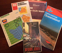
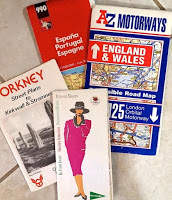
Then we come to stacks of maps that I, and then Betsy and I, have bought on our travels. They take me back with great joy to the many places we have been, but they tend to be more of the highway route variety of map and less emotive in detail than the old ones.
I love all maps, and these are a small percentage of my collection, but the old maps are special. There is somehow something surreal about seeing all these places that have loomed so large in my early life depicted so clearly before me on a long-forgotten map. I am grateful to whoever chose this topic for giving me the incentive to explore the contents of that dusty old box.
And, not for the first time, I find myself grieving for the current and future high-tech generations.  I fear they will never know the magic of an old map, tattered from overuse, with pencil arrows flowing from a scribbled teenage note, trilobite fossils here. Who, with the very best of intentions, can find magic in the memories of Siri scolding, ‘you are going in the wrong direction! Complete a U-turn immediately it is safe to do so and return to the intersection.’  Seriously lacking in any sense of history!
I have decided against naming my next baby Siri.

© 31 Mar 2017 
About the Autho
I was born and raised in England. After graduation from college there, I moved to the U.S. and, having discovered Colorado, never left. I have lived in the Denver-Boulder area since 1965, working for 30-years at IBM. I married, raised four stepchildren, then got divorced after finally, in my forties, accepting myself as a lesbian. I have been with my wonderful partner Betsy for thirty-years. We have been married since 2013.
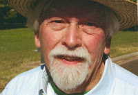
Maps, by Ray S

I believe that along with counting all the fingers and toes and necessary plumbing each one of us is issued a map. This is a map that charts out the many roads we may or may not venture onto. There will be the inevitable dead ends, forks in the road leading to where? Most of we dreamers look for the legend marking the Yellow Brick Road, and occasionally it is found. Then there are a good number of us that don’t study our map or perhaps never open it. We just head for the dark woods and wander aimlessly through life gathering rosebuds where we may.

If there is a goal, it just happens as we trudge on through the expedient trail or path.

It can happen to a fortunate select group that broke the seal on their maps to plan their routes to health, wealth, and of course, happiness. We’ve all met one of those hims or hers.

All of the roads on your map will lead to great and small adventures, and ultimately end at the same destination.

© 27 March 2017

About the Author

Maps, by Pat Gourley

It has now been nearly 37 years since the second national Radical Fairie Gathering here in Colorado in the late summer of 1980. That event was the brainchild of Don Kilhefner, Harry Hay, John Burnside, and Mitch Walker with logistical help from an energetic collective of gay fairies here in Denver.

There are many parts of that event that have stuck with me for these several decades but one in particular comes to mind from time to time. This recollection involves a workshop led by Harry Hay that I did not attend but that I got a first hand report on from James Broughton, the eclectic poet and film maker. I may have been too caught up in dealing with the endless stream of issues that arose before and throughout the gathering to get to this particular workshop. Pressing issues like why was only vegetarian food available and the decision to not have heated water for the showers, something of a logistical challenge but dismissed finally as too bourgeois.

Harry was always all about trying to get us to answer the question “who are we”. According to the workshop report I received from James, Harry had declared that afternoon that we were all Shamans. This seemed fitting I supposed at the time since the confab was called A Spiritual Gathering for Radical Fairies. There are many complex layers to being a Shaman but the one I relate to most is that of “healer”. I do think it is a very worthwhile endeavor on our part to explore the many traditional and contemporary roles we queers are so often disproportionally drawn to.

These often-queer related roles were explored in some detail in Christian de la Huerta’s wonderful 1999 book, Coming Out Spiritually. He delineated the following roles we are often drawn to:

· Catalytic Transformers: A taste for revolution

· Outsiders mirroring society

· Consciousness scouts: Going first and taking Risks

· Scared Clowns and eternal youth: A Gay Young Spirit

· Keepers of beauty: Reaching for the Sacred

· Caregivers: Taking for Each Other

· Mediators: The In-between people

· Shamans and Priests: Sacred functionaries

· The Divine Androgyne: An evolutionary role?

· Gatekeepers; Guardians of the Gates

So in the spirit of this week’s topic of “maps” I would like to add one more role that if I contort my logic enough could be one that underpins all of those listed above and that would be cartographer.

A cartographer of course is a mapmaker. Maps are used to find one’s way from here to there. The larger society certainly has not historically, and is only now just beginning, to provide us with any positive space to get in touch with “whom we are”. I would dare to say that of the roles identified by de la Huerta all are initially engaged in as attempts to map our way. Forms of self-expression that often blossom into roles of great benefit to ourselves and society as a whole.

How do we find our way out from under the suffocating heterosexual cocoon we are born into? I would say it is by being the very creative cartographers we have learned to be. The maps are many and varied some written down but many come in the rich forms of oral history we have developed. What is this SAGE story telling group really but a form of mapmaking and sharing?

All of our maps provide guidance in answering those initial Mattachine questions of “who are we, where did we come from and what are we for”. In whatever forms our maps really are, at their most base level, they are the means for ‘pointing the way’. They are not forms of recruitment but rather loving crumbs left along the path to queer enlightenment by those who have come before, back to our earliest human ancestors. Our job as queer cartographers of course leads to these roles that have great altruistic benefit to the whole dance that is sentient life on earth.

© March 2017

About the Author

I was born in La Porte, Indiana in 1949, raised on a farm and schooled by Holy Cross nuns. The bulk of my adult life, some 40 plus years, was spent in Denver, Colorado as a nurse, gardener and gay/AIDS activist. I have currently returned to Denver after an extended sabbatical in San Francisco, California.

Maps: Scotland and the Presbyterian Church by Louis Brown

Last week one of our fellow authors made a harmless remark about the Presbyterian Church. I know Telling Your Story does not actually have a religious purpose. Nevertheless, a few interesting things have been happening in the world of American Christian churchdom. To celebrate this month, Women’s History Month, March 2017, you might want to choose to read The Red Tent (1997) by Anita Diamant. It is the story of Dinah, daughter of Jacob, and the plot takes place in the pre-Decalogue days of ancient Jewish history. Women had to go to live in the Red Tent once a month during menstruation and to go there to have their babies with the assistance of the numerous midwives.

Dinah was a midwife. Dinah finally decides to marry Shalem, son of the king of Shechem, fortified city in Egypt. Shalem and a large number of the adult men in Schechem are murdered by Simon and Reuben, two of Jacob’s sons. These two also strip brother Joseph of his colorful coat and toss him into a well. Joseph has the power of interpreting dreams so is taken up by the king of Egypt and is made into a Vizier. The Pharaohs come later. The plot goes on and on with war, betrayal, murder and generally a picture of a really blood-stained history of primitive society. It is an extremely well-written book and celebrates women, all women.

Another religious book worth noting is The Shack (2007) by William Paul Young. A 50 year old religious man, Mackenzie Phillips (“Mack”) whose wife Nan refers to God as Papa, goes on an outing with his three children in an Oregon woods near Multnomah Falls, and a murderer abducts his 6 year old daughter Melissa and murders her. Local Police and even the FBI go on a search for the girl and find her blood-stained dress in a Shack. Mack looks at the red dress and is horrified. Mack gets very angry with God for permitting such a crime to have taken place. Why wasn’t God there to protect his daughter? A few months later Mack received a short note from “Papa” (from God?) asking him to come to the Shack, the scene of the last sign of Missy (Melissa) was found.

Mack doubted the note actually came from God but accepted the invitation, and went with a gun in case the note was a ruse, a note sent by the murderer of Melissa or other malefactor. Once Mack gets to the Shack, he falls asleep and has a dream in which he visits with God, a black woman, the Holy Spirit, an Asian woman and with Jesus. He quarrels with God, but assists Sarayu, the Holy Spirit, with arrangements for his daughter’s burial. He finds the location of his daughter’s cadaver by following red signs on rocks and trees that the murderer had previously placed there. The new male God assists Jake with this discovery.

Mack wakes up from his dream, goes with the local police and discovers Missy’s body lying in a cave. I saw the movie of this book and everybody wept when Missy gets buried in a graveyard that was heavily decorated with flowers bay Sarayu. The Shack was an unusually well-written story. It discusses Christianity honestly.

If you recall, the other religious work that impressed me was the poetry of Rumi. Last night on MSNBC I saw a documentary about a Scottish doctor who got a job with his wife Riyadh, Saudi Arabia. The Scottish doctor was gay. When he got to Riyadh, he was forced to live in a dirty apartment, and, when he tried to make contact with any of a large number of willing same-sex partners, the religious police caught on to him, they spied on him, then threatened to send him to jail. Arabian homophobia does not come from the Koran, in my opinion, it comes from the Arabian government trying to brown-nose Queen Victoria, our true larger enemy.

Speaking of Scotland, the Church of Scotland is the Presbyterian Church. Donald Trump is a Scottish Presbyterian whereas my family were English Presbyterians. The Presbyterian Church is said to be the boring church. I am spiritually a Presbyterian, although, since I do not own property or have a million dollars in the bank, I actually do not qualify to become a “real” member of the Presbyterian Church which is ever so slightly snobby. But I am still knocking on their doors.

I descend from the Reverend Robert Brown who obtained his MDiv (Master of Divinity) from the University of Glasgow in 1725 and also from the right reverend James Bishop Wilcox who established the Presbyterian seminary in Middlebury, Vermont around 1830. Reverend Robert Brown became an itinerant minister in Northern Ireland. James Bishop Wilcox married a certain Prudence Aldrich and had many children, however, many of these children were still-born. In the daguerreotype from around 1835 I used to have of Prudence Aldrich, she looked very bitter in a Puritanical sort of way. My grandmother told me that was because of the many miscarriages she suffered.

© 20 March 2017

About the Author

I was born in 1944, I lived most of my life in New York City, Queens County. I still commute there. I worked for many years as a Caseworker for New York City Human Resources Administration, dealing with mentally impaired clients, then as a social work Supervisor dealing with homeless PWA’s. I have an apartment in Wheat Ridge, CO. I retired in 2002. I have a few interesting stories to tell. My boyfriend Kevin lives in New York City. I graduated Queens College, CUNY, in 1967.

Maps, by Phillip Hoyle

I like maps. They remind me of a map game we played at home when I was a kid. Mom would get out some old geography books and world atlases and hand them out to us older kids. Then she’d say, “Find the Europe map.” When we all had one she’d say, “Prague,” or “the Volga River.” She might say find the Asia map, and then call out, “The China Sea,” or “The Bay of Mandalay.” Her challenge for the South America map might be, “Asunción,” or “The Amazon River.” The first one to find the place—and show it to her—was the winner. The winner would then pick out the next place name, a river, city, country, sea, ocean, continent, and so forth. One of the special challenges of the game was that the maps were not the same, so a river might not be named in one of the books. I suppose it trained our pronunciation and our ears for the language suffixes that might indicate a location by country. The teacher in Mom created a number of these games for her children to play, but I especially liked the map game. 

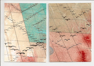
Map-like Art Cards by Phillip Hoyle 2017
Migrating birds.

Now I paint on maps, print on maps, sometimes even write on maps. I collect them from brochure racks in tourist places and at rest stops along freeways. I tear them out of magazines and occasionally buy one at a convenience store. I look for them in antique shops and secondhand stores. I sometimes cover them with thinned gesso or acrylic paints to make a ground for a mixed media work. I splatter them, pattern them, block out spaces, or tear them in order to match some traveler’s dream. I print on them, draw on them, paint on them, glue other things on them and in so doing create places of memory or worlds of fantasy. Most of my map messages are personal, a few political. With these maps I travel, juxtaposing unusual images, feeding some internal need that is often unclear to me, the artist. I go to places in my art, places that feed me, soothe me, please me, challenge me. I often don’t even pause to look up the name of the place. I wonder what my mother would make of these map games I now play. But I know of all the unusual people I have befriended, she would be the most likely to understand.

© 20 March 2017

About the Author

Phillip Hoyle lives in Denver and spends his time writing, painting, and socializing. In general he keeps busy with groups of writers and artists. Following thirty-two years in church work and fifteen in a therapeutic massage practice, he now focuses on creating beauty. He volunteers at The Center leading the SAGE program “Telling Your Story.”

He also blogs at artandmorebyphilhoyle.blogspot.com

My Fault, by Jude Gassaway

You can see my fault from outer space.

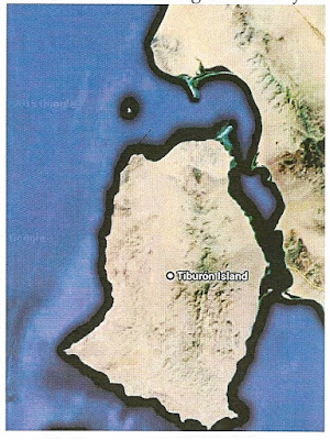
Of the two big islands in the Gulf of California, Tiburon is the one closest to the Mexican mainland. Seen from above, the northeastern lobe shows a sharp line heading northwest, delineating lighter ground to the north. That straight line is my fault.

Air photo, Tiburon Island (Google Maps)

     In the winter of 1972, just as the subject of plate tectonics was getting started, another student and I were assigned to map the northeast end of Tiburon Island for our Graduate Field Geology class at San Diego State University.
     
     The week before, while mapping on the mainland, we met a pair of Wycliffe Bible translators, whose mission was to bring the word of God to native people. The Religious’ approach was to identify, define, and transcribe the local vernacular, and then translate the Bible into the new language. Here, they focused on the Seri Tribe.

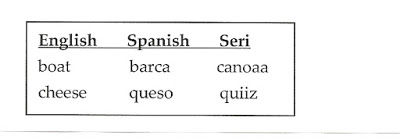
     In Punta Chueca, I met a Seri man who wanted to demonstrate his new reading skills. He had a lesson pamphlet with everyday words in English, Spanish, and Seri. I remember two of the words because of their similarity.
     

A few Seri place names on our base map included oddities like Sierra “Kunkaak” and the multi-hyphenated Punta “Ast-Ho-Ben-O-Glap”.

Our professor, in the course of drafting the geologic map and interpreting the history, had to name and describe the geologic observations. The fault in my field area was just a bit off-kilter to the then-known regional picture. It needed a name so that its geologic significance could be discussed in the text. There were no place names in the fault valley.

I was unaware of the professor’s solution until the map was published several years later. The professor told me that he had noticed that I thought differently and that I often veered off to a little bit away from the others, just as this fault wandered. (As the only woman in the class, sometimes I moved away just to relieve myself.) Then, he thought, “yawassag” –that sounded kind of like a Seri word. And thus, Yawassag Fault was named. Jude Gassaway.

Gastil. R.G., and Krummenacher, Daniel, 1975, Reconnaissance geologic map of coastal of coastal Sonora between Puerto Lobos and Bahia Kino, Geological Society of America, map and Chart Series, MC-16.

  © 2017

About the Author

Retired USGS Field Geologist.
Founding member, Denver Womens Chorus. 
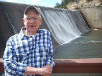
Jude Gassaway is the figure on the left.